Issue #1: Wetlands exist in the project parcel and are worth restoring and protecting
Significant areas of wetlands exist within the proposed “Kenley” development. Some areas are seasonally wet “vernal pools”, some areas remain wet year-round. Yet other portions were farmed extensively in the past and have not been cultivated for agriculture in many years.
These wetlands, are part of the open space that surrounds Buffalo Grove and attract significant wildlife including coyotes, spring peepers and other amphibians, Red-tail and other hawks, ground hogs, opossums, white-tailed deer and many other animals.
All of the proposed development is currently zoned “R-1” which limits the density and development of this land and keeps open space for wildlife as well as a buffer for Old Farm Residents.
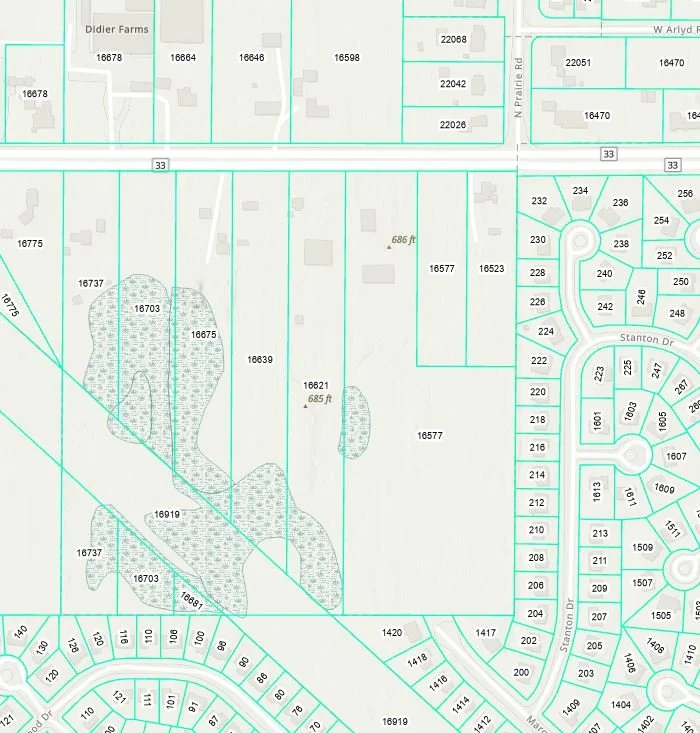
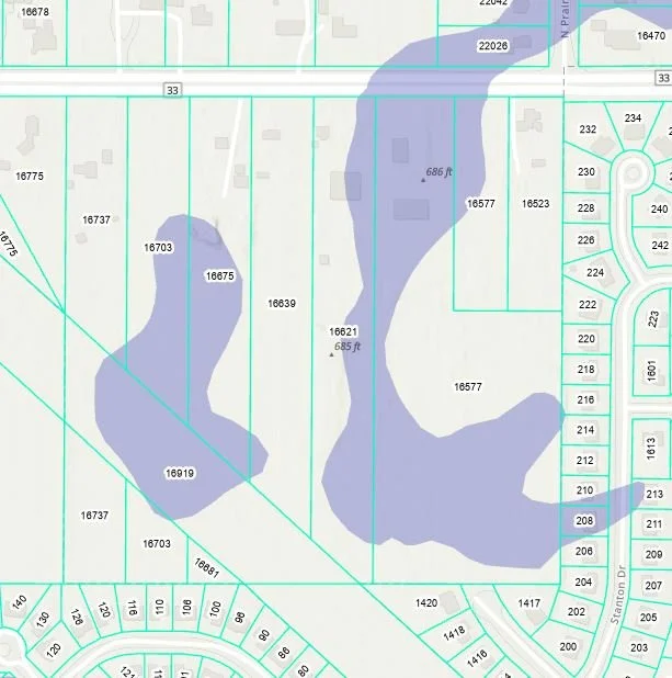
Map showing areas of wetlands within proposed project as determined by the Lake County Wetland Inventory (LCWI). Some of these areas are impaired from decades of farming but may still possibly contain features that could enable restoration.

Topographical Wetness Index (TWI) indicates position of unmapped vernal pool. The Topographic Wetness Index (TWI) is a way to predict where water is likely to accumulate on a landscape based on its shape (topography). It helps identify areas that are more likely to be wet, saturated, or prone to runoff accumulation. This circled areas currently serves as springtime habitat for Spring Peepers (Pseudacris crucifer)
Hydric soils are soils that form under conditions of saturation, flooding, or ponding long enough during the growing season to develop anaerobic (low-oxygen) conditions in the upper part of the soil profile..
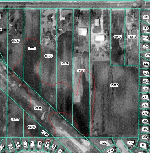
Aerial imagery of proposed development from 1993. Circled in red are the wetlands mapped in the LCWI.

Site elevation and wetland boundaries as presented by M/I Homes in the 7/21/25 presentation to Village Trustees. The vernal pool is indicated as "low point"